Animal Exposure Model for Mapping Crimean-Congo Hemorrhagic Fever Virus Emergence Risk
Emerging Infectious Diseases – Journal
Abstract
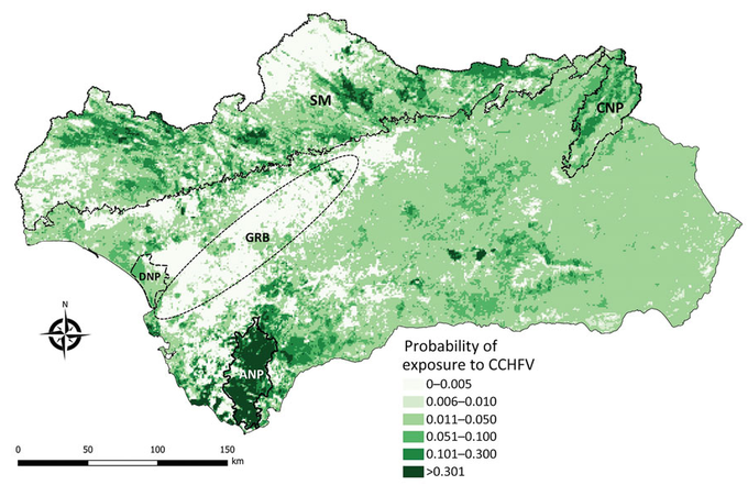
To estimate the determinants of spatial variation in Crimean-Congo hemorrhagic fever virus (CCHFV) transmission and to create a risk map as a preventive public health tool, we designed a survey of small domestic ruminants in Andalusia, Spain. To assess CCHFV exposure spatial distribution, we analyzed serum from 2,440 sheep and goats by using a double-antigen ELISA and modeled exposure probability with environmental predictors by using generalized linear mixed models. CCHFV antibodies detected in 84 samples confirmed low CCHFV prevalence in small domestic ruminants in the region. The best-fitted statistical model indicated that the most significant predictors of virus exposure risk were cattle/horse density and the normalized difference vegetation index. Model validation showed 99.7% specificity and 10.2% sensitivity for identifying CCHFV circulation areas. To map CCHFV exposure risk, we projected the model at a 1 × 1-km spatial resolution. Our study provides insight into CCHFV ecology that is useful for preventing virus transmission.